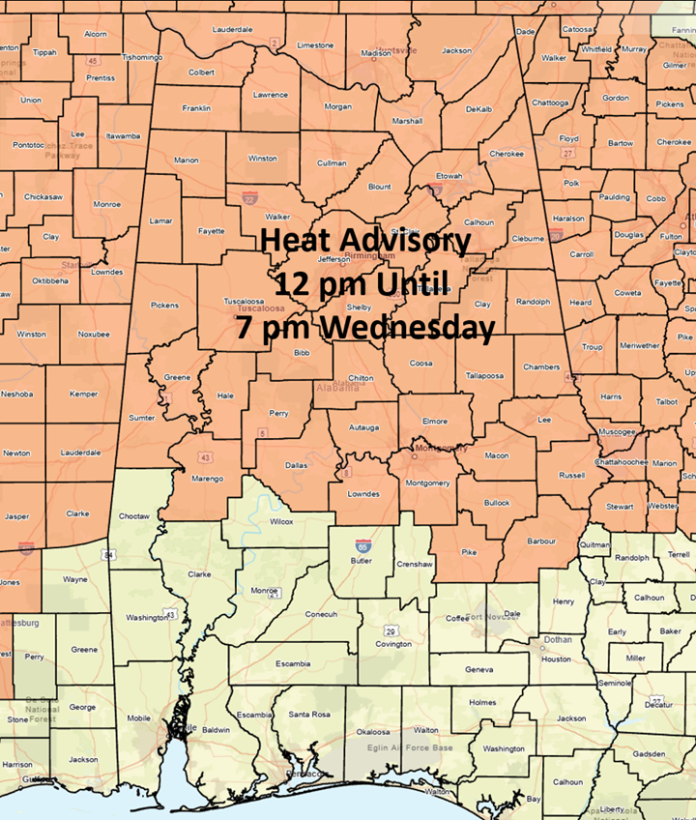
Heat Index values in the Advisory area will reach 103-108 today and again tomorrow with very little cooling overnight. Limit outdoor activity, stay in shaded or air-conditioned areas and drink plenty of water.

A few storms are possible near the coast today, with isolated storms elsewhere. However, most of Alabama will remain rain-free. An upper-level low-pressure area is forecast to develop near the Florida Peninsula on Wednesday and travel westward. Storms will develop in Georgia during the afternoon and move westward into Alabama during the afternoon and evening hours.
It is possible clusters of storms could develop across the southern half of the state as outlined in the SPC Slight Risk area. Damaging wind gusts are the main threat.
Scattered to numerous showers and thunderstorms will develop each afternoon and evening statewide from Thursday through the weekend. Besides frequent lightning, a few storms each day could produce damaging wind gusts.


