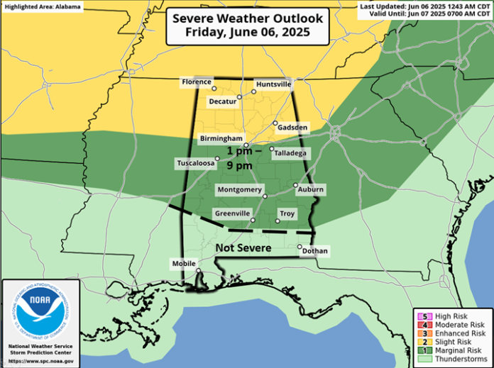
Scattered to numerous thunderstorms will develop across much of state this afternoon with the highest concentration over the northern half of Alabama. A few damaging wind gusts and hail are the main threats. All storms should dissipate between 9 pm and 12 am.
From Saturday through at least Monday, the state will be affected by a number of Mesoscale Convective Systems (MCS) or clusters of strong to severe thunderstorms. There is much uncertainty with both timing and specific locations more than 12-24 hours in advance for each event. Very heavy rain with localized flooding, damaging wind gusts and hail in spots are the main threats.
On Saturday, a MCS is expected to move from north to south across much of the state during the afternoon and evening hours. The SPC considered upgrading portions of northern Alabama to an Enhanced Risk for wind damage potential, but has held off at this time.

Another MCS is possible across the northern half of the state from around 12 am until 10 am Sunday, with yet another cluster of storms possible Sunday afternoon and evening. However, due to the morning storms the atmosphere may remain somewhat stable during the afternoon and evening and the SPC has only gone with a Marginal Risk for most of Alabama.

Yet another MCS is expected to move across the state on Monday with another round of heavy rain and severe weather potential. The unsettled pattern continues with rain and thunderstorms forecast from Tuesday through next Thursday.


