CLANTON – Winds on Tuesday morning will be on the increase and by afternoon frequent gusts from 25-35 mph will occur, with a few gusts potentially as high as 40 mph continuing ahead of a line of showers/thunderstorms. Wind Advisories are in effect for almost the entire state beginning at 12 pm Tuesday.

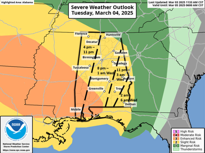
A few supercell thunderstorms may develop across the western and especially the southwestern portions of the state, followed by a line of storm. The line will enter the western portions of Alabama after 6 pm Tuesday, race eastward, and exit the southeastern portions by 6 am Wednesday.
Damaging wind gusts and a few tornadoes are possible. A couple of tornadoes may be EF2+ in the Enhanced Risk area. The line will be weakening as it moves over the eastern sections of the state. However, there is high wind shear (to promote rotating updrafts), and just the momentum of the line itself, moving at 40-60 mph, could produce pockets of wind damage.
Behind the line, gusty winds will continue between 15-25 mph with a few gusts up to 35 mph Wednesday morning through the afternoon hours.
Another system Saturday into Sunday will bring rain and some thunderstorms across the state, but it is still unclear at this point if severe weather will occur.


