A Mesoscale Convective System (MCS) or large cluster of thunderstorms has produced wind damage and hail near and south of I-20 this morning. This system will exit the eastern portions of the state by 8:30 AM.
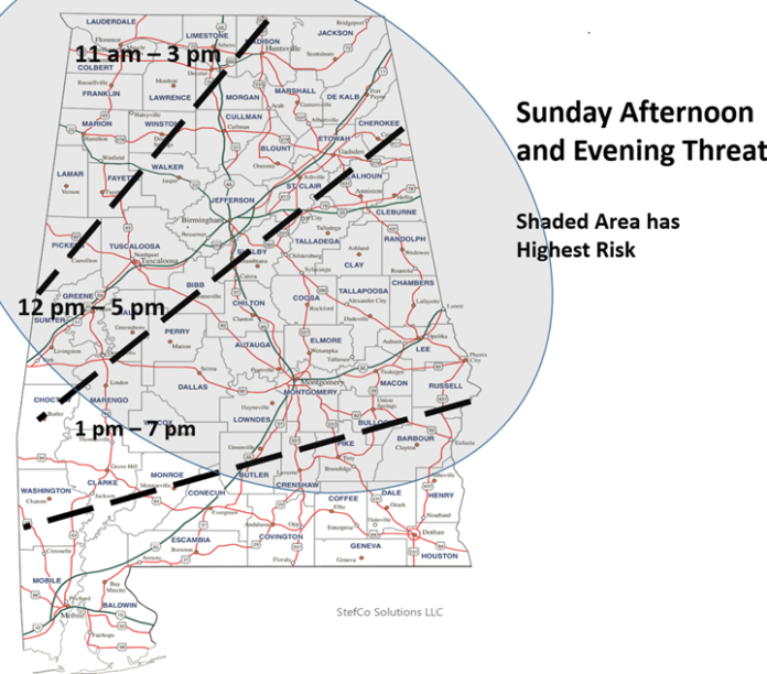
After a short break, another MCS is expected to reach northwestern Alabama after 11 AM and move southeastward through early evening. The exact track of this MCS is uncertain but will likely occur north of a Livingston – Troy – Eufaula line.
Damaging wind gusts, hail, and both intense and frequent lightning will occur. If you hear thunder, get indoors to a safe location. A more widespread severe weather threat will likely occur with a strong cold front Tuesday into early Wednesday. A line of thunderstorms, with the potential for cells to develop ahead of the line, will enter northwestern Alabama after 3 PM Tuesday. The storms will move southward and exit the southeastern portions of the state sometime after sunrise Wednesday. Damaging wind gusts, hail, and possibly a couple of tornadoes will be the threats, especially across the northern half of the state.


