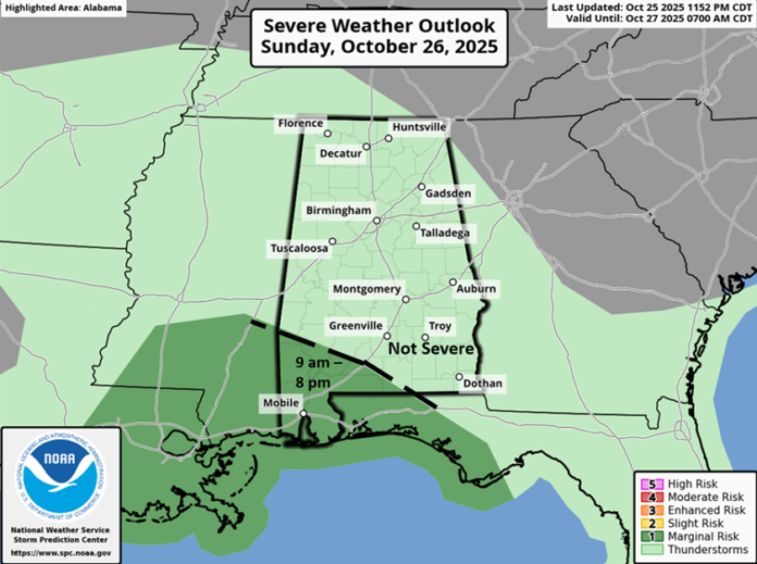
…Low-end severe threat continues for southwestern sections…
As of 7 am, rain was entering western Alabama with thunderstorms closer to the coast. The precipitation will spread across the state throughout the morning, continue tonight and end in the eastern sections by early Monday afternoon.
A couple of damaging wind gusts are possible after 9 am today in the southwestern sections, and potentially a couple of tornadoes in Mobile and Baldwin counties. Redevelopment of storms will likely occur by late morning or early afternoon with a continued threat for isolated damaging wind gusts and a couple of tornadoes in the southwestern areas into the early evening hours.
Very beneficial rainfall will occur through Monday with widespread 0.5-2 inches and locally higher amounts in stronger storms, especially over southwestern Alabama where isolated flash flooding is possible.


