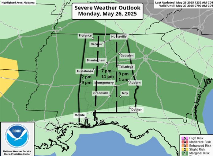
A Marginal Risk is in effect for most of the state today through at least Wednesday.
The next upper-level disturbance will spread rain and thunderstorms beginning early to mid-afternoon in the western sections and spreading eastward into early Tuesday. Heavy rainfall with localized flooding, frequent lightning, a few wind gusts from 40-60 mph, and hail are all possible. However, this system will not produce the intense or widespread wind damage that occurred Sunday in western and northern Alabama.
The upper-level disturbance train keeps coming through Friday, with scattered to numerous showers and storms along with breaks in the activity each day. The next systems will affect the state both Tuesday and Wednesday afternoon and evening. Once again, localized flooding, frequent lightning, a few wind gusts from 40-60 mph, and hail are all possible. The predictability for the timing of the systems beyond Wednesday is low at this time.
The state will FINALLY see a break from the stormy weather this weekend.


