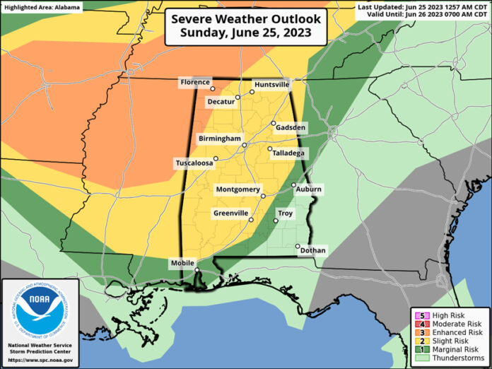
CLANTON, Ala. – Two waves of thunderstorms are expected from this afternoon into Monday morning, both of which will likely produce some severe weather.
The first wave will enter northern Alabama early to mid-afternoon and affect areas mainly north of I-20 through 5 pm.
The second wave will enter northern Alabama between 5 pm and 8 pm, combine with the first wave of storms and continue southward across the state into Monday morning.
Damaging straight-line winds and very large hail are possible with both waves, especially west of I-65. Timing graphics are provided but due to the small size/cluster of storms with each wave, timing may still change in later updates.
These storms will likely pack a punch much more a typical summertime severe storm. If you plan to be outdoors today, make sure you keep up to date with the latest warnings and get to a shelter if issued. If planning to be out on the water, you should absolutely get to shore and take shelter if skies darken, and thunder is heard.
On Monday afternoon, a few storms may develop mainly east of I-65 and a couple of storms could produce damaging wind gusts and hail, but widespread severe weather will not occur.
Finally, excessive heat will be on the rise this week. A Heat Advisory is in effect today for Washington and Mobile counties, as it will feel like 109 degrees in many locations this afternoon. Heat Advisories will expand to other sections of the state later this week.


