CLANTON – Saturday, 800 am October 25, 2025
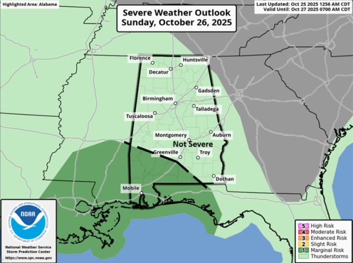
…Low-end severe threat continues for southern section’s Sunday…
A couple of upper level disturbances will move across the southeastern U.S. on both Sunday and Monday. Rain will begin entering western Alabama around sunrise Sunday and spread eastward across much of the state throughout the morning. There may be a break in precipitation during the early afternoon before another wave of showers and storms begins by late Sunday afternoon and continues into Monday evening.
The good news is that many locations will receive 0.5 – 1.5 inches of rain with isolated higher amounts by Monday evening. Concerning severe weather in the southern areas, it is still unclear on the timing with a couple of scenarios possible.
The first scenario would be strong to severe storms between 7 am and 12 pm Sunday. If this occurs, this could diminish the severe potential late Sunday afternoon and evening. The second scenario would be for weaker storms during the morning, which could result in stronger, discrete storms in the afternoon and evening. A few damaging wind gusts and even a couple of tornadoes are possible in either scenario, but especially in the second one.


