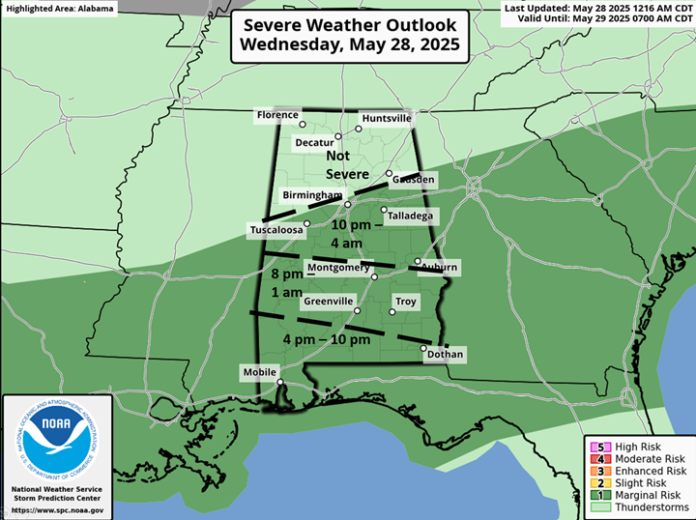
Most of the state will remain dry today into the evening hours. The exception will be near the coast, where the sea breeze will produce thunderstorms that will move inland mid to late afternoon. Then, yet another upper-level disturbance will move out of southern Mississippi and into southwestern Alabama after 8 pm. A cluster of storms are expected that will move northeastward and lose intensity near I-20 early Wednesday morning.
A few wind gusts from 40-60 mph and localized flooding may occur, but widespread severe weather is not expected.
Several clusters of storms will move across portions of the state from mid-morning Thursday through Friday evening. Predictability on the exact timing for each cluster is low at this time. Once again, a few wind gusts from 40-60 mph and localized flooding are possible with each cluster, but widespread severe weather is unlikely.
The state will FINALLY get a break with little to no rainfall forecast from Saturday through at least next Tuesday.


As a reminder, National Weather Service Mobile is having its required computer system upgrade, and NOAA Weather Radio will be down through Thursday for the areas shaded blue in the graphic below.


