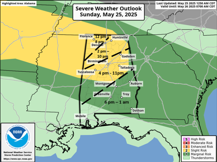
A line of storms is likely today, enter northern Alabama early to mid-afternoon and travel southward through the evening hours. Damaging wind gusts and hail will be the main threats, especially across the northern half of the state. As the line reaches the southern half of the state this evening, it will weaken with only a couple of damaging wind gusts possible. There is no tornado threat.
Yet another disturbance will move across Alabama on Monday. Although much of the state is under a Marginal Risk, the latest high-resolution model data suggests the northern half will have the best chances for thunderstorms and potentially a few damaging wind gusts and hail during the afternoon and evening hours.

Scattered to numerous thunderstorms will continue to occur from Tuesday through much of the week due to additional upper-level disturbances moving across the southeastern US. The timing of each system is uncertain this far in advance. However, if they occur during the afternoon and evening hours, a few damaging wind gusts and hail will be possible each day.

Finally, between 1-3 inches of rain fell yesterday, both for areas north of I-20 and also across the western half of the state west of I-65. An additional and widespread 2-5 inches of total rainfall is forecast from today through Wednesday morning across the northern half of Alabama. There will likely be much higher totals where stronger storms occur. Localized flooding will be possible each day and continue into the latter part of this week.


