









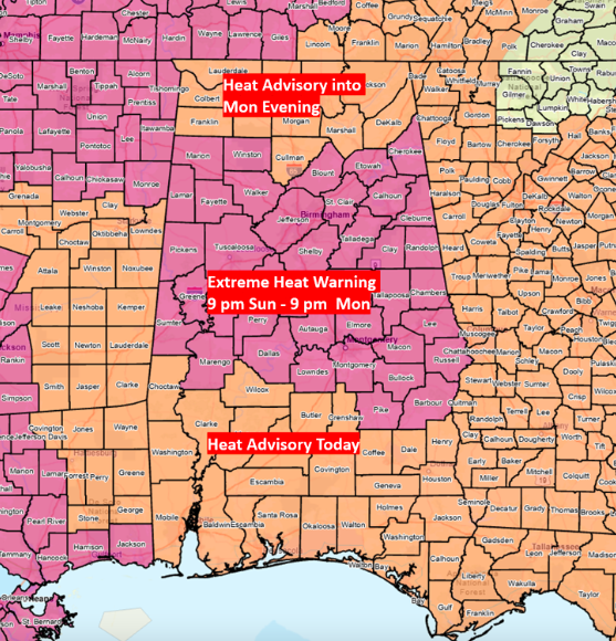
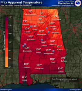
An Extreme Heat Warning is in effect for all of central Alabama through 9 p.m. A Heat Advisory is in effect for the remainder of the state.
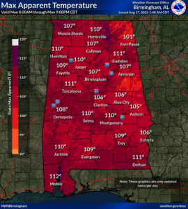
Afternoon Heat Index values could reach as high as 113 in spots across central Alabama this afternoon. It is unlikely the warning will be extended past this evening as slightly drier air is expected to filter into the northern half of the state. However, Heat Advisories will continue into the middle to latter part of the week for the central and southern sections, especially south of I-20.
Scattered thunderstorms are forecast to develop south of I-20 this afternoon and evening. A couple of storms could produce wind gusts from 40-60 mph.
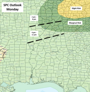
North of I-20, scattered to numerous thunderstorms, possibly forming into clusters, will develop across the far northern sections of the state and move southward into the late evening hours. Although the SPC does not have all areas near and north of I-20 in a Marginal Risk as of 6 am, high-resolution model data indicate that any area in this region could experience a few wind gusts from 40-60 mph, frequent lightning, and torrential rainfall. A timeline graphic is shown below.
The upper-air pattern will change during the week to a northwest flow, meaning a few Mesoscale Convective Systems (MCS) are possible in the southeastern US moving from northwest to southeast. Although it is unclear at this point whether any of these systems will affect Alabama, it appears that rain chances will increase from Thursday into the weekend.