Meteorologist Jim Stefkovich, Alabama Emergency Management Agency
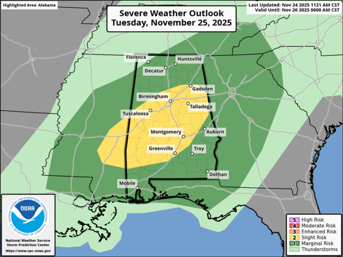
CLANTON, Ala. – A few storms in western Alabama may become more discrete supercells very early Tuesday morning, and supercells may again form both ahead of and within a line of storms mid- to late-Tuesday morning through the evening hours. As a result, there could be a slight uptick in both tornado and straight-line wind damage potential.
Two rounds of showers and thunderstorms will occur from late Monday night through Tuesday evening. The first round will mainly affect the western half of the state from midnight through 8 a.m. A few damaging wind gusts, hail and possibly a tornado or two are the threats in the far western sections between 1-8 a.m.
Then, showers and thunderstorms will develop both ahead of and along a cold front that will enter northwest Alabama after 7 a.m. Tuesday, move southeastward throughout the day and exit the southeastern portions by Wednesday morning. Once again, damaging wind gusts, hail and a couple of tornadoes are all possible with this second round, especially within the SPC Slight Risk area.
Total rainfall amounts will generally be 1-2 inches across the northern half of the state with an inch or less across the southern half.
After a dry and cool period from Wednesday afternoon through early Thanksgiving weekend, an active pattern is forecast from Sunday afternoon through the middle of next week.


