A very active pattern will occur into early next week.
Scattered to numerous showers and thunderstorms will develop mainly across both the southern half of the state and also for areas east of I-65 both today and Thursday during the afternoon and evening hours. No severe weather is expected.
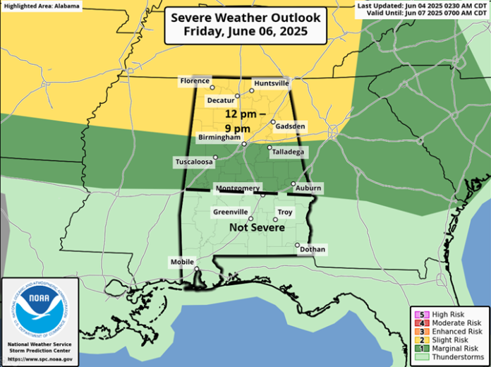
On Friday, it is still unclear whether scattered thunderstorms will develop across Alabama or a Mesoscale Convective System (MCS) with clusters or a line of storms will enter the northern sections Friday afternoon and move southward into the evening hours. Regardless of either scenario, a few damaging wind gusts are possible near and north of I-20, with isolated damaging wind gusts south of I-20 to a Livingston – Montgomery – Auburn line from 12 pm – 9 pm. Heavy rainfall will also occur with the stronger storms, with localized flooding possible.
From Saturday through Sunday morning, a couple of upper-level systems will affect the state with clusters of storms most likely during the afternoon and evening hours. Much of Alabama is under a Slight Risk. Damaging wind gusts are possible, and very heavy rainfall will occur with localized flooding.
There could be another severe threat and localized flooding Sunday afternoon and evening if the atmosphere can recover from earlier storms. Additional rounds of showers and thunderstorms will occur Monday and Tuesday but both timing and any severe threat is unclear at this time.


