
CLANTON – Wind Chill and Hard Freeze Watches have been issued for much of the state from Thursday evening or early Friday through the Christmas weekend. The National Weather Service will likely be issuing a Hard Freeze Warning statewide and Wind Chill Warning for all but the far southern sections of Alabama in later forecasts.
Mostly light rain will move into the state Thursday afternoon and end Friday morning, with rain turning into snow showers after 9 pm Thursday in north Alabama, north of a Hamilton – Cullman – Gadsden line, and ending between 8 am – 12 pm Friday. Rain could mix with snow south of this line to I-20. A few snow flurries are possible Friday morning and afternoon across the northern half of the state.
Between a trace and up to ½ inch of snow is currently forecast mainly near and north of the Tennessee River. However, no significant road impacts are expected across the state due to very strong winds helping to dry roadways. The exception may be in sheltered areas if any snowfall or freezing of water occurs.
Very strong winds statewide will occur from Thursday evening through Saturday morning, with sustained winds of 15-25 mph and gusts between 30-35 mph. Winds will begin to subside Saturday afternoon.
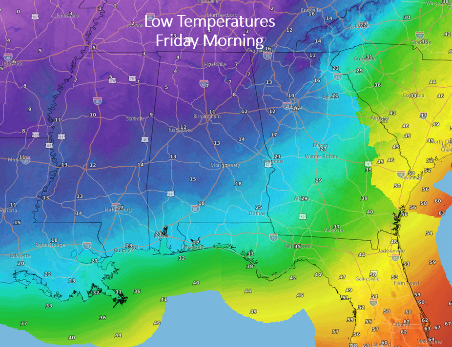
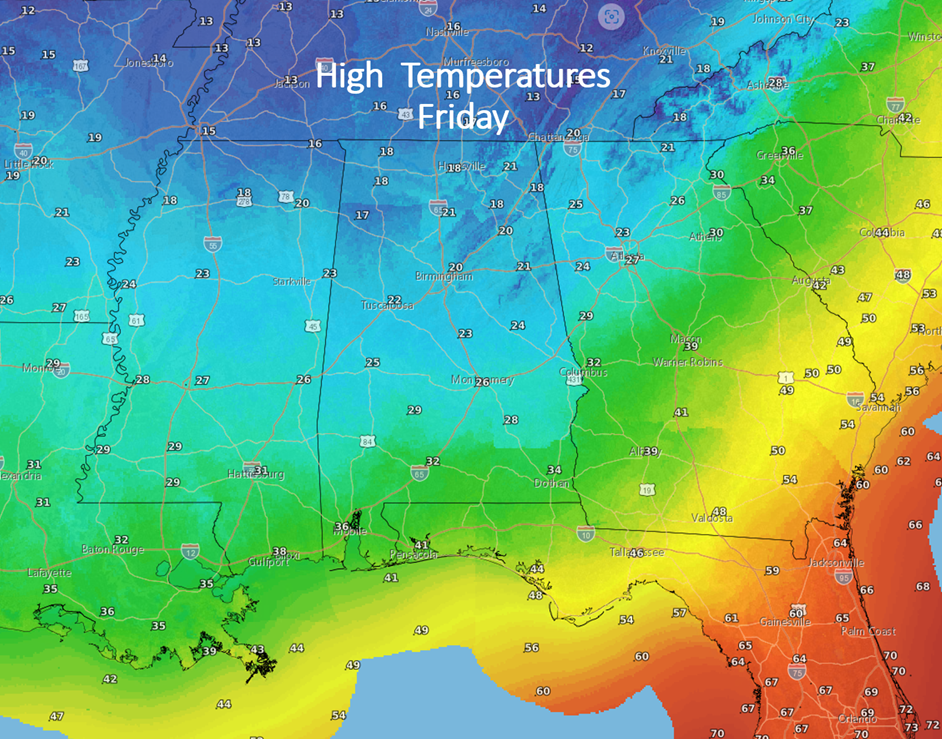
Temperatures by sunrise Friday are forecast to be in the single digits in far northern Alabama with lower to middle 20s along the coast. High temperatures on Friday will range from the middle teens north to middle 30s south. Only areas in the far southern sections of the state are forecast to get above freezing.
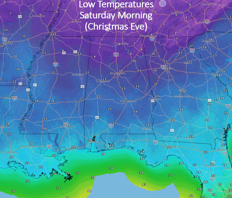
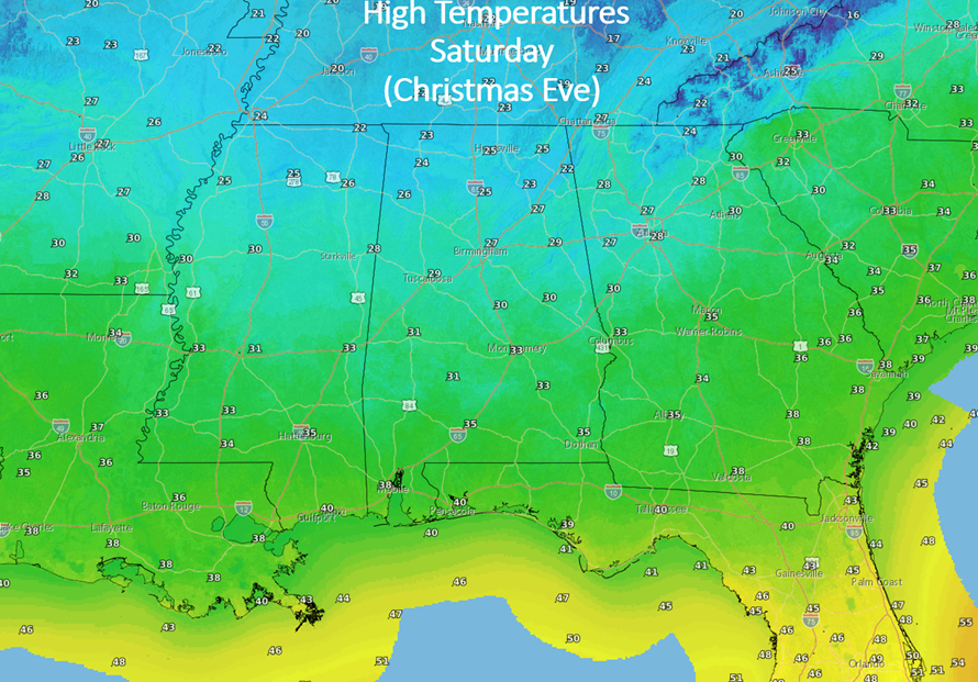
It will be even colder Christmas Eve (Saturday morning) with actual air temperatures in the single digits north to teens along the coast. Saturday afternoon will see high temperatures from the 20s north to upper 30s at the coast.
The combination of cold temperatures and high winds will produce dangerous, life-threatening wind chills of -5 to -15 degrees from Thursday evening through Saturday morning in the northern sections of the state, and readings of 0 to -10 degrees in the central sections all the way to Hwy 80 – I-85.
With temperatures this cold, remember to protect the three “P’s” – People, Pets and Pipes. Some safety information is provided at the end.
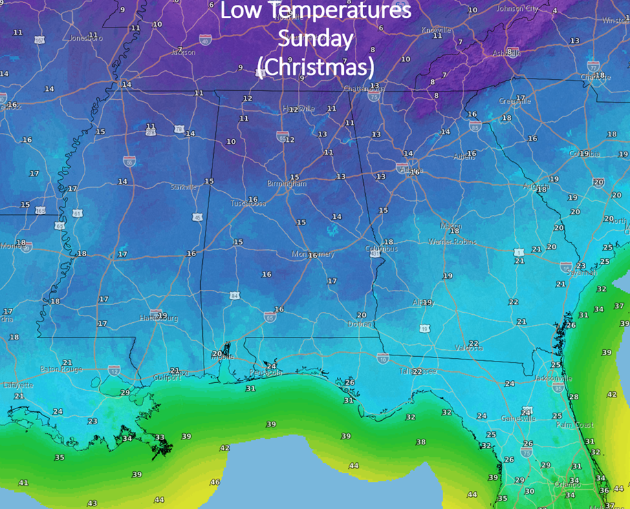
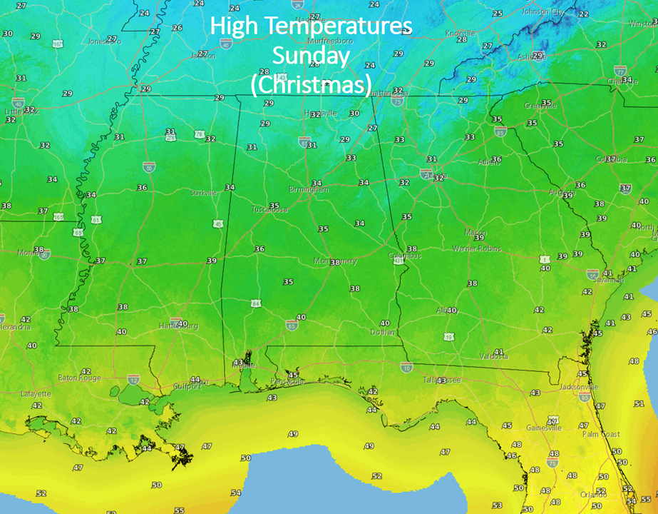
Temperatures will remain very cold with lows Christmas Day in the lower teens north to around 20 at the coast with high temperatures from the upper 20s north to middle 40s near the coast. Many areas of north Alabama will remain below freezing from early on the 23rd until the afternoon of the 26th or 27th.


