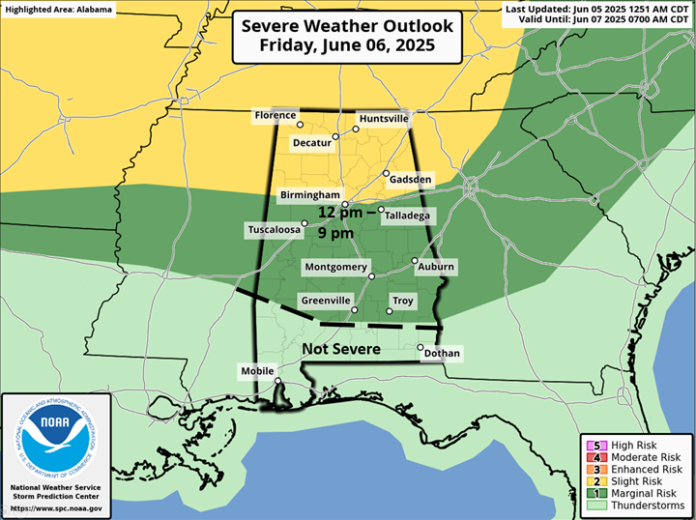
Concerning Friday, it is still unclear whether scattered thunderstorms will develop across Alabama or a Mesoscale Convective System (MCS) with clusters or line of storms will enter the northern sections during the afternoon and move southward into the evening hours. Regardless, a few damaging wind gusts are possible near and north of I-20, with isolated damaging wind gusts south of I-20 and into the southern sections from 12 pm – 9 pm. Heavy rainfall will also occur with the stronger storms, with localized flooding possible.
On Saturday, latest guidance suggests another MCS will affect much of the state during the afternoon and evening hours with damaging wind gusts and heavy rainfall. Both the timing and locations for individual MCS activity from Sunday into next week is uncertain at this time due to the relatively small size of each system.

I suspect portions of the state will be under at least a Marginal Risk both Sunday and Monday, possibly into Tuesday in later updates. Widespread rainfall near and north of I-20 through early Sunday will be 1-3 inches with locally higher amounts in stronger storms. With rainfall continuing into next week, the threat for flooding will increase from Sunday through Tuesday across much of the state.


