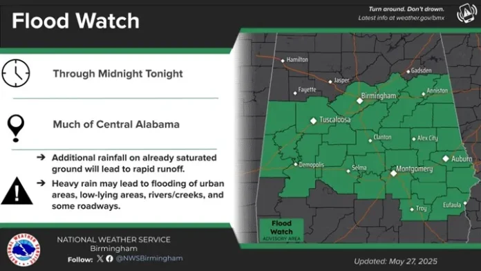
A Flood Watch is in effect for Central Alabama until 12 AM.
A line of thunderstorms will affect areas east of I-65 through mid to late afternoon. Very heavy rainfall producing localized flooding, a few wind gusts from 40-60 mph, and hail are all possible.
Then, although not totally clear, another large cluster of thunderstorms “could” form in western Mississippi by mid-afternoon and move eastward, affecting areas generally south of I-20 through early Tuesday. What is unclear is if the atmosphere will have enough time to recover from the first round of storms. If so, a few damaging wind gusts and hail will be possible. If not, there will be very little chance of damaging winds and hail.
Regardless, some areas will likely once again receive very heavy rainfall that could produce localized flooding.


National Weather Service Mobile is having its required computer system upgrade, and NOAA Weather Radio will be down through Thursday for the areas shaded blue in the graphic below.


