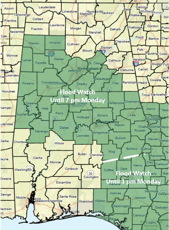
A Flood Watch is in effect into Monday for portions of central and southeastern Alabama.
From Friday through early Sunday morning, widespread 1-3 inches of rain with spots over 5 inches have occurred generally south of I-20. Through Tuesday afternoon, bands of showers and thunderstorms will continue to form across the state, especially during the afternoon and evening hours. Some storms within the bands will move repeatedly over the same areas.
An additional and widespread 0.5-2 inches of rain is forecast through Tuesday, with much higher amounts where the bands form. This could lead to flooding issues, especially where the higher amounts have already fallen since Friday.
Never drive into waters of unknown depth, especially if that water is moving. It only takes 18-24 inches of standing water for vehicles to lose contact with roadways.

In addition, a few wind gusts from 40-60 mph and hail are possible this afternoon until early Monday morning south of a Hamilton – Birmingham – Auburn line. A brief tornado or two are also possible, but the overall tornado threat is very low.
On Monday, a Marginal Risk exists for part of the state for the potential of a few hail-producing storms to quarter-size. The threat of wind damage is very low.
Dry conditions will finally arrive on Wednesday and last through at least Friday.


