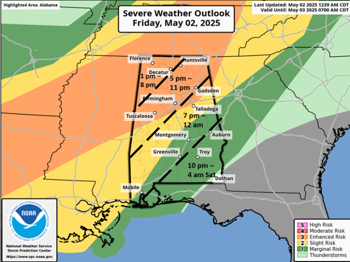
…Areas near and north of I-20 upgraded to Enhanced Risk today…
Due to forecast higher instability and a slightly southward track of the upper-level system, there is an increased risk of severe storms, especially near and north of I-20.
Clusters of thunderstorms will begin affecting northwestern Alabama by early afternoon, southward to I-20 by late afternoon and south of I-20 this evening into early Saturday.
Damaging wind gusts and hail are the primary threats, and a couple of tornadoes are also possible in the Enhanced Risk region. However, the overall tornado threat is low. In addition, there is a much lower threat of severe weather tonight south of I-85 and east of I-65.
On Saturday, another upper-level disturbance will trigger widespread showers and thunderstorms across the state. As of right now, expected cloud cover will keep instability rather low. As a result, just a few wind gusts from 40-60 mph are possible. There is no tornado threat.
Total rainfall from today through early Sunday will generally be 0.5-2.5 inches, with locally higher amounts in stronger storms. This could lead to brief flooding issues, but widespread flooding is not anticipated.


