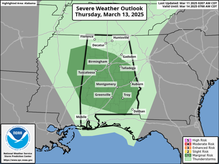
An upper-level disturbance will produce scattered to numerous showers and thunderstorms statewide from late Wednesday night through Thursday evening. A few storms could produce wind gusts of 40-60 mph and hail to the size of golf balls between 9 am and 7 pm Thursday.
Non-thunderstorm, commonly called pressure gradient winds, will be on the increase Friday morning and by afternoon gusts of 15-25 mph will occur increasing to 20-30 mph Friday evening into Saturday morning.
Clusters of storms are expected to move into the central half of the state between 9 pm Friday and 7 am Saturday. All modes of severe weather are possible, including tornadoes, damaging straight-line winds, and large hail.
On Saturday, pressure gradient winds will contain gusts from 25-35 mph across the state. Another wave of thunderstorms is expected to develop across the western sections of Alabama Saturday morning or by early afternoon, move eastward Saturday evening and night, and exit the southeastern portions by Sunday morning.
The Saturday morning into Sunday event favors both supercells and an eventual line of strong to severe thunderstorms. All modes of severe weather will once again be possible, including tornadoes (a few EF2+), damaging straight-line winds, large hail and flooding.
No rain is forecast from Sunday afternoon through at least next Wednesday morning.


