
CLANTON – Wednesday, 8:00 am December 21, 2022
As expected, the National Weather Service has upgraded Wind Chill and Hard Freeze Watches to Warnings across much of the northern 2/3 of the state, with Hard Freeze Watches in the southern 1/3.
Mostly light rain will move into the state Thursday afternoon or early evening and end around daybreak Friday morning. Rain will turn into snow showers after 7 pm Thursday north of a Hamilton – Cullman – Gadsden line. Between a trace and ½ inch of snow is forecast in this region. The exception may be just south of Wheeler Lake in north AL, where Lake Effect snow is possible. Yes, Lake Effect snow occurs in Alabama! It is unclear if this will occur, and any additional accumulations would be close to the lake.
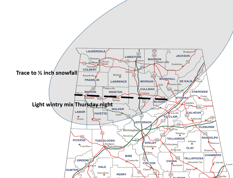
Just south of this line, rain could mix with snow, and may briefly mix with light freezing rain, but no accumulations nor impacts are expected. A graphic is provided below.
Due to overall very light precipitation amounts of 0.10 inch or less with this system, no significant road impacts are expected across the state due to very strong winds helping to dry roadways. The exception may be in sheltered areas if any accumulating snowfall or freezing of water occurs.
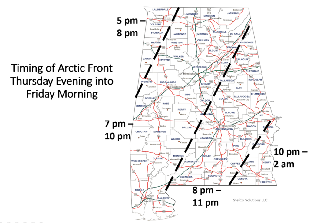
Very strong winds statewide will occur from Thursday evening through Saturday morning, with sustained winds of 15-25 mph and gusts between 30-35 mph. Winds will begin to subside Saturday afternoon. A timing graphic for the arctic front and initial push of bitterly cold air is shown below.
Temperatures by sunrise Friday are forecast to be in the single digits north of I-20, teens to Hwy 80 – I-85, and lower to middle 20s along the coast. High temperatures on Friday will range from the middle teens north to middle 30s south. Only areas near the coast are forecast to get above freezing.
Christmas Eve (Saturday morning) will have low temperatures in the single digits near and north of I-20 north to teens along the coast. Saturday afternoon will see high temperatures from the lower 20s north to upper 30s at the coast.
The combination of cold temperatures and high winds will produce dangerous wind chills of -5 to -15 degrees from early Friday through Saturday morning in the northern sections of the state, and readings of 0 to -12 degrees in the central sections all the way to Hwy 80 – I-85.
Temperatures will remain very cold with lows Christmas Day in the lower teens north to around 20 at the coast. High temperatures will range from the upper 20s north to middle 40s near the coast. Many areas of north Alabama will remain below freezing from late evening on the 22nd until the afternoon of the 26th, but even then only for a few hours with readings in the middle to upper 30s. Low temperatures on the 27th will again drop below freezing for all of the state except near the coast.


