








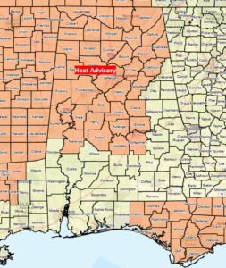
A Heat Advisory is in effect for north and most of central Alabama today, with afternoon Heat Index values from 101-107. Heat Advisories will likely be expanded to the entire state by this weekend, with some areas potentially reaching Excessive Heat Warning criteria by Sunday or Monday.
High temperatures today will be in the lower to middle 90s, in the lower to upper 90s Thursday, and mainly in the middle to upper 90s Friday through the weekend. A few areas may reach 100-102 degrees Saturday through Monday. Drink plenty of water and limit outdoor activity from late morning through the early evening hours.
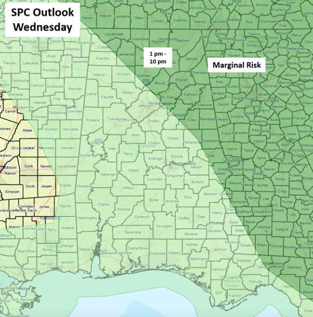
Scattered thunderstorms are forecast to develop across the northern and eastern sections of the state this afternoon and persist into the evening. A few storms may produce wind gusts from 40-60 mph. Isolated to scattered thunderstorms are forecast across eastern Alabama on Thursday, and once again, a couple of storms may produce wind gusts from 40-60 mph. After Thursday, little to no rainfall is forecast through next Monday.
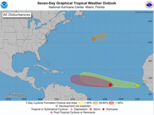
A tropical wave in the central Atlantic will likely become a tropical depression in the next couple of days. Models are now indicating the system will reach the eastern Caribbean sometime this weekend. A tropical wave just offshore from the African coast has a 20% chance of development as it moves westward for the next week. Finally, a tropical wave in the north Atlantic is moving eastward away from the US.
There is no immediate threat from tropical activity to Alabama. Just something to keep an eye on beginning next week. This is the time of year when tropical waves move off the African coast and move westward, so expect to see more of these systems for the next month or so.