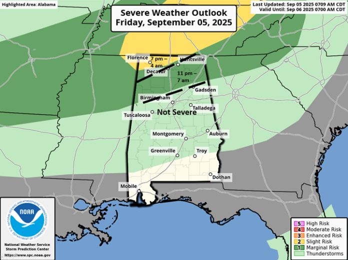
Two waves of thunderstorms are possible, generally north of I-20, this evening into Saturday.
The first wave has the highest severe threat when a broken line of thunderstorms will enter the northwestern sections after 7 pm and move southward, dissipating somewhere near or north I-20 by early Saturday morning. A few damaging wind gusts and hail are the main threats.
A second line of thunderstorms along a cold front will enter the northwestern sections after 6 AM, reach I-20 by 11 AM, and again weaken as it moves across the southern half of the state through Saturday afternoon. A few wind gusts from 30-40 mph are possible near and north of I-20 with this second line. Little to no rainfall is forecast from Sunday through at least next Thursday.
An area of low pressure in the eastern Atlantic will likely become a tropical depression this weekend or early next week. Models continue to strengthen this system as it approaches the Lesser Antilles by the middle to later part of next week. There is no tropical activity forecast for the Gulf during the next 7-10 days.


