
CLANTON – Scattered to numerous showers and a few thunderstorms will move across the state through this afternoon. No severe weather will occur. Although isolated showers are possible after sunset, most precipitation will have ended.
Patchy dense fog is forecast to develop later this evening and continue into Sunday morning. Use caution while driving tonight and allow plenty of time to reach your destination, as visibilities may be near zero in spots.
A number of upper level disturbances will affect Alabama from Monday afternoon through Wednesday, with periods of rain and thunderstorms.
Widespread rainfall totals of 1-3 inches will occur and possibly higher amounts in spots. Localized flooding is a threat Tuesday into Wednesday.
Concerning severe weather, a couple of strong storms may occur Monday afternoon across the southern half of the state and west of I-65, but confidence is low. Widespread severe storms will not occur.
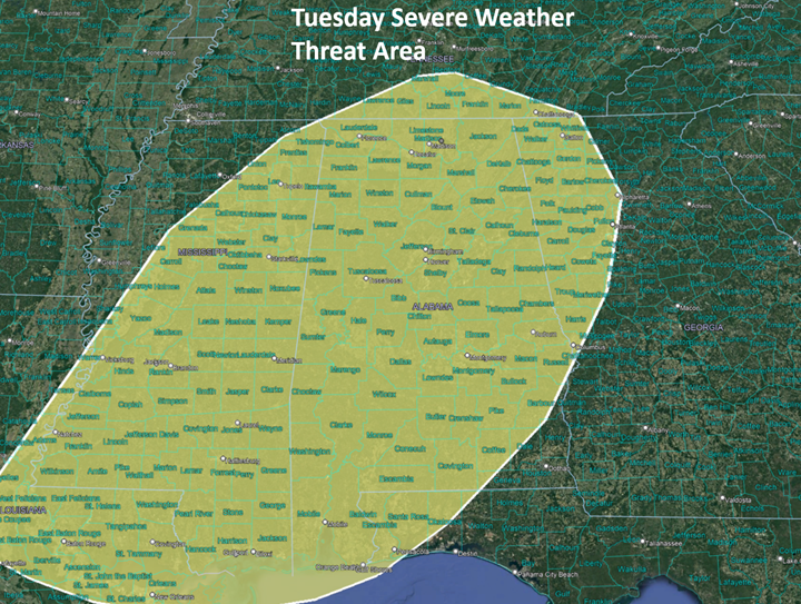
On Tuesday, a broken line of thunderstorms is forecast to move across Alabama from afternoon into the overnight hours. The SPC has outlooked almost the entire state in a risk for severe weather.
The final disturbance will produce statewide rainfall on Wednesday, but severe weather is not expected at this time.


