
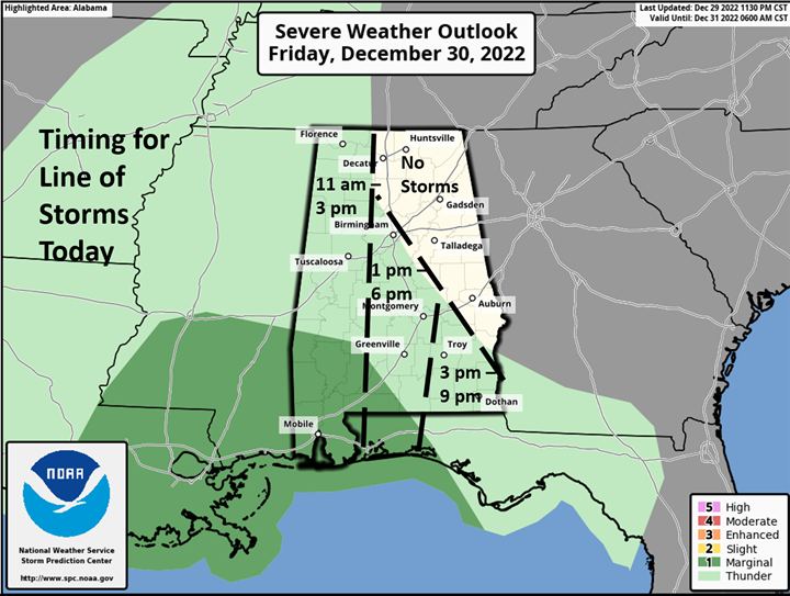
CLANTON – A number of upper level disturbances will affect Alabama over the next six days. Today, a line of thunderstorms will move into the western portions of the state sometime between late morning and early afternoon, followed by an area of moderate to heavy rainfall for several hours.
The atmosphere will be most unstable in the southwestern portions of the state, where a few severe storms are possible. Damaging straight-line winds and a couple of tornadoes are the main threats. Remember, severe weather, including tornadoes, occur in Marginal Risk areas, just not as widespread as the other risk categories.
This system will be moving quickly so rainfall totals will not be as high as previously forecast. Between 0.5 – 2 inches are forecast south of I-20, and a few higher amounts could occur south of Hwy 80 – I-85. Less than one inch totals are forecast north of I-20.
On Saturday, rain and thunderstorms will move across the state from morning through the afternoon. A couple of severe storms are possible east of I-65 and south of I-85.
The main threat will be damaging straight-line winds. An additional 0.5 – 1.5 inches of total rainfall are forecast with this system.
All rain will have ended across the state between 6 – 8 pm Saturday, but areas of dense fog could develop during the evening or overnight hours.
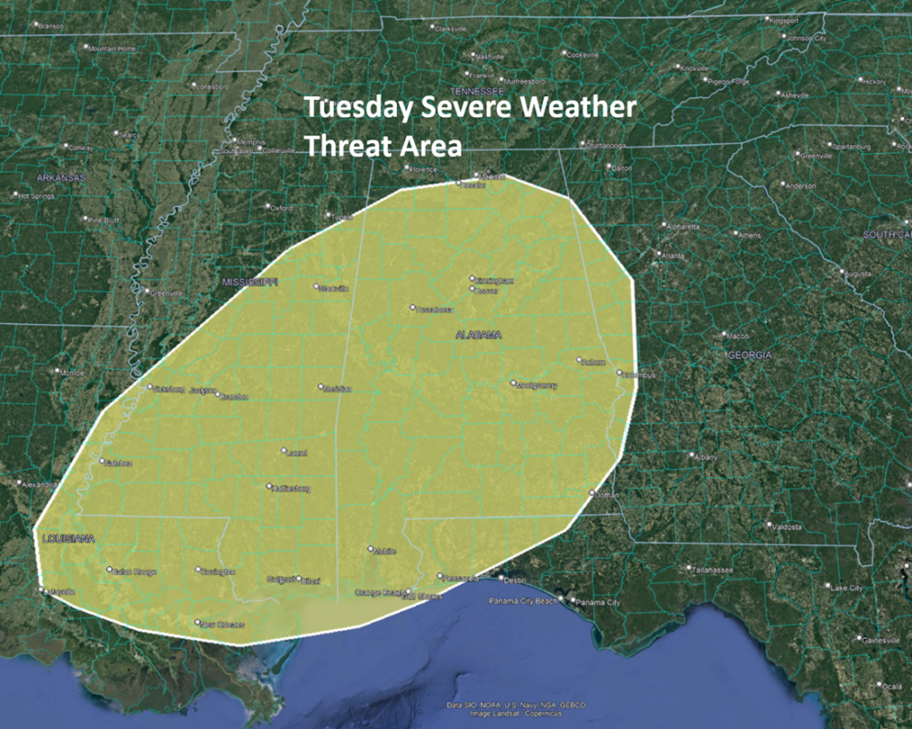
After a break from rainfall, Saturday evening through early Monday, periods of rain and thunderstorms will again move into Alabama Monday afternoon or evening and continue through Wednesday, January 2-4. An additional 1-3 inches of total rainfall is forecast.
Also, the Storm Prediction Center (SPC) has outlooked almost the entire state in a risk for severe weather, as a line of storms will likely move from west to east during the afternoon and evening hours.


