
Jim Stefkovich, meteorologist, Alabama Emergency Management Agency
CLANTON, Ala. – Sunday, March 15, 2026, noon
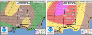
…Almost the entire state is now in an Enhanced Risk due to an increase in damaging wind probabilities…
Non-thunderstorm winds will be on the increase this afternoon and evening ahead of a line of severe thunderstorms. Sustained winds will be 10-20 mph with gusts from 20-30 mph south of I-20 and 25-35 north of I-20. A few gusts could reach 40 mph in the higher elevations of north Alabama.
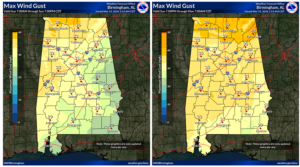
Timing has not changed since this morning, nor the reasoning, as scattered to widespread wind damage will occur with a fast-moving line of thunderstorms, along with embedded tornadoes. In addition, models continue to indicate a few supercells could develop ahead of the line, especially east of I-65 and south of I-85. If these supercells develop, long-tracked tornadoes are possible.
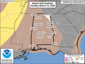
As you can see from the graphics below, the damaging wind threat probabilities have increased across the entire state, as well as the potential for 70+ mph winds. The statewide threat for a few EF2+ tornadoes continues as well.
Does this mean every inch of our state will have severe weather? NO! But the potential exists for significant severe storms everywhere. Still, it is expected that many locations will be impacted. EVERYONE needs to remain alert this evening and tonight.
This is the type of event where Severe Thunderstorm Warnings should be treated like Tornado Warnings.
Since this will mainly be a nighttime event, make sure you have at least two methods to receive severe weather warnings, one of which is NOT an outdoor warning siren.
If a warning is issued, get to the lowest floor in a sturdy building, putting as many walls between you and the outside as possible. Finally, ensure you and those with you are wearing helmets (sports, biking, work) and sturdy footwear. You don’t want to walk around barefoot in case damage occurs.
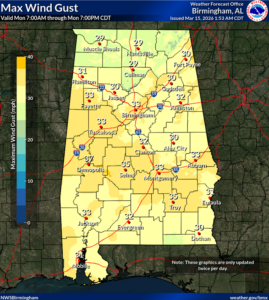
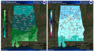
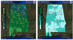
Temperatures will be dropping rapidly during the day on Monday, and statewide winds behind the front will contain gusts from 20-35 mph through the afternoon. In addition, some snow showers and/or sleet may occur Monday morning, possibly as far south as a Livingston – Montgomery – Auburn line. No winter impacts are expected.
A hard freeze will occur Tuesday morning with low temperatures from the lower 20s north to middle 30s near the coast. Highs on Tuesday will be from the lower 40s north to middle 50s south. Lows Wednesday morning will again drop below freezing in many locations with middle 20s to middle 30s. A warm-up will begin on Wednesday.


