







CLANTON – Monday, 7:00 am, August 31, 2026
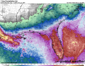
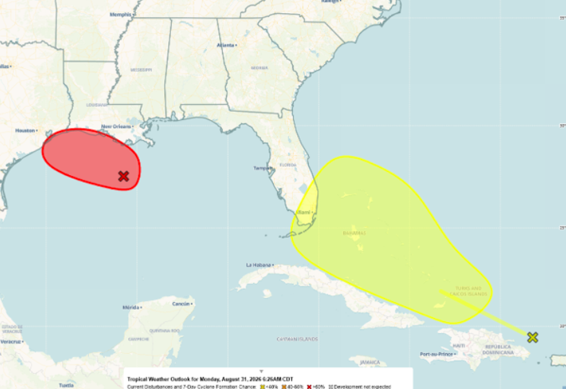
An area of low pressure off the Louisiana coast will likely become a short-lived tropical depression or tropical storm before making landfall along the Upper Texas or southwestern Louisiana coasts by tonight or Tuesday. Heavy rainfall will be the main impact.
A broad area of low pressure near Hispaniola continues to move quickly west-northwestward at 20 to 25 mph. There is only a 10% chance of tropical development as the system will continue to encounter unfavorable upper-level winds this week.
This system in the Gulf will help produce scattered showers and thunderstorms across the far southern sections of the state today and Tuesday, with dry conditions across the remainder of Alabama. Scattered showers and storms are forecast across the southern half on Wednesday, south of I-20 on Thursday, and statewide both Friday and Saturday.
Heat Index values will rise this week, with afternoon readings of 100-106 across most of the state beginning Tuesday.