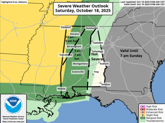
A line of thunderstorms will enter the western portions of the state between 12 am and 3 am, move eastward throughout the morning hours, and exit the southeastern portions by early afternoon. There could be a few winds damaging wind gusts and even a couple of tornadoes, especially across the western half of Alabama. However, widespread severe weather is unlikely.
This system will bring widespread 0.5 – 1 inch of rainfall to Alabama, with some spots receiving more where stronger storms exist within the line. However, this will provide little relief to ongoing drought conditions. Cooler temperatures and no precipitation are in store from Monday through Friday.


Much of the state is in a moderate to severe drought, with extreme conditions for portions of western Alabama.
The Alabama Forestry Commission continues a Statewide Fire Danger Advisory until further notice. Refrain from doing any burning and never leave a fire until it is extinguished. Always obtain a permit for prescribed burns, and ensure adequate equipment and personnel are present. Do not dispose of burning cigarettes in grassy or other fuel-burning areas, as this can start fires.


