










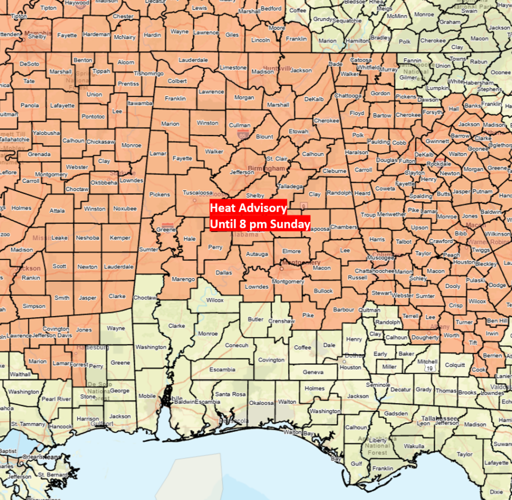
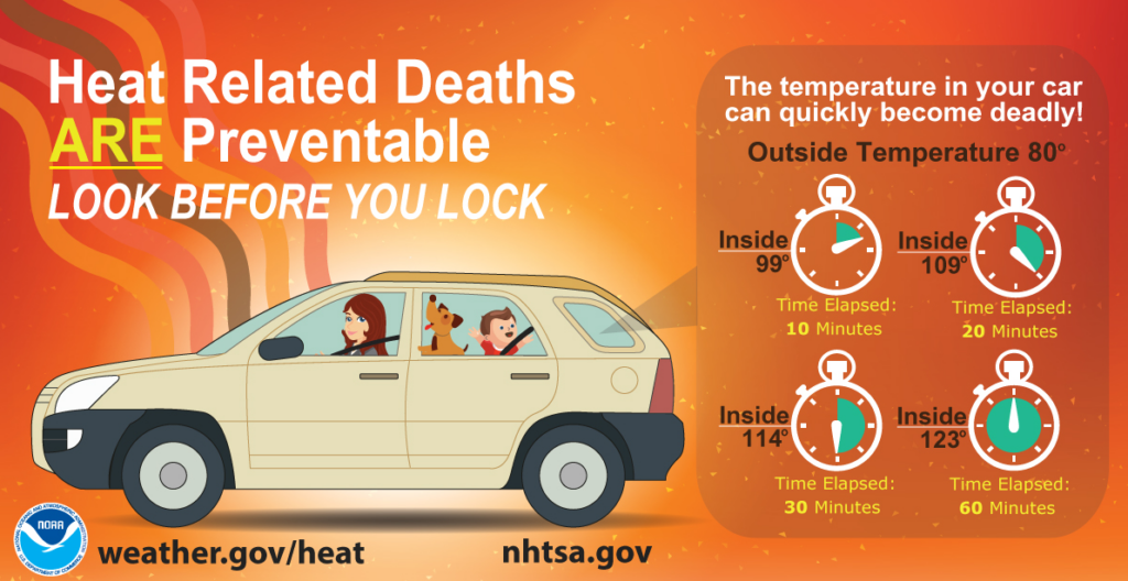
A Heat Advisory is in effect for the northern 2/3 of Alabama through 8 pm today, with afternoon heat index values from 105-109. The National Weather Service is not planning to extend the advisory past this evening.
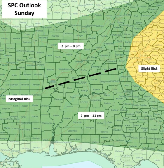
Scattered showers and thunderstorms will be on the increase this afternoon and continue into this evening. A few storms will produce wind gusts from 40-60 mph. Since the atmosphere will become very unstable this afternoon, the entire state has been placed under a Marginal Risk for severe storms by the SPC.
Scattered showers and thunderstorms, mainly during the afternoon and early evening hours, are forecast generally south of I-20 on Monday and south of a Livingston-Montgomery-Auburn line on Tuesday. Once again, a few storms each day could produce wind gusts from 40-60 mph.
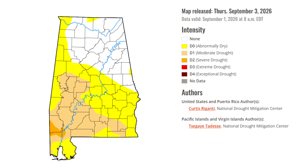
Finally, drought conditions continue to worsen, with moderate drought across both the western and far southern sections of the state. Unfortunately, although a few spots may receive rainfall in typical summertime thunderstorms, no widespread, significant rainfall is forecast for the next seven to 10 days.