








CLANTON – Monday, 5:00 am, August 24, 2026
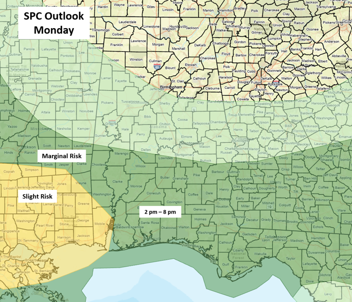
A Mesoscale Convective System (MCS) or cluster of storms is likely to form this morning in northern Mississippi and move southeastward into the evening. Models indicate the highest chances of severe weather will be across southern Louisiana and Mississippi, and possibly as far east as coastal Alabama, as outlined in the Slight Risk area.
Still, scattered to numerous showers and thunderstorms are forecast to develop south of the Livingston – Montgomery – Auburn line, and a few wind gusts from 40-60 mph are possible, along with torrential rainfall that may lead to localized flooding this afternoon and early evening. Storms will dissipate rapidly after 8 pm.
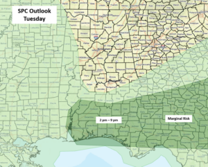
On Tuesday, scattered thunderstorms are forecast mainly across the far southern sections of the state. Once again, there may be a few wind gusts from 40-60 mph during the afternoon and early evening hours.
Periodic rounds of showers and thunderstorms will occur from Wednesday through Friday, and there will likely be some risk of damaging wind gusts each day. However, confidence in both timing and location is very low this far in advance.