







CLANTON – Tuesday, 6:30 am, July 28, 2026
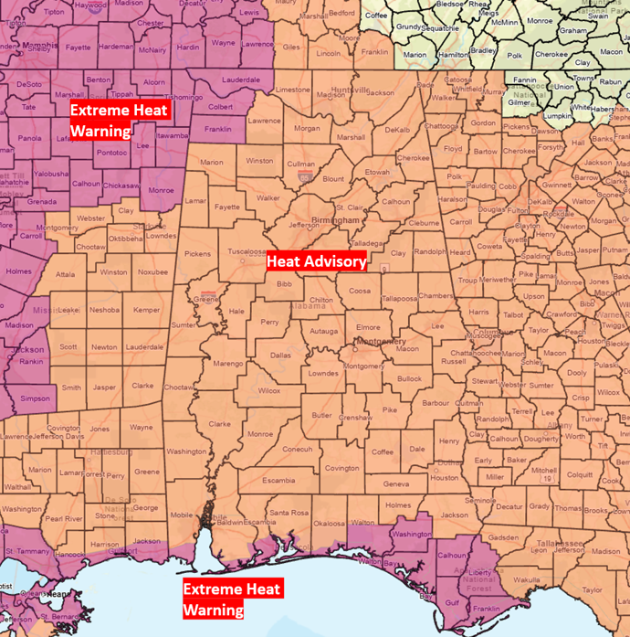
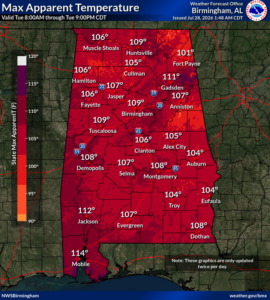
An Extreme Heat Warning is in effect for Lauderdale, Colbert, Franklin, and both coastal Mobile and Baldwin counties due to Heat Index values from 108-114 today. The rest of the state is under a Heat Advisory for Heat Index Values from 101-112.
Limit outdoor activities, especially this afternoon, and drink plenty of water to stay hydrated.
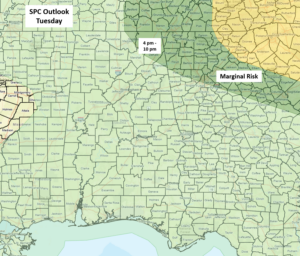
A Mesoscale Convective System (MCS) may provide a glancing blow to the northeast sections of the state late this afternoon and evening. A couple of storms may produce wind gusts from 40-60 mph. As stated in previous briefings, MCS location and timing can change quickly. There is a chance the storms could be a little farther westward into the state, or eastward with no severe potential.
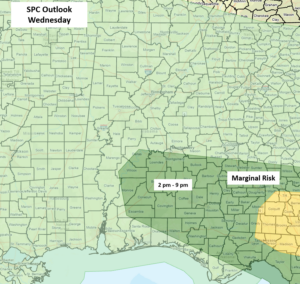
Drier air will begin to filter into Alabama on Wednesday, except for the southern half where scattered to numerous showers and thunderstorms will likely develop during the afternoon hours and last into the evening. A few 40-60 mph wind gusts are possible. A Heat Advisory may be needed Wednesday for the southern sections and possibly an Extreme Heat Warning for the coastal areas.
The far southern sections will have scattered afternoon and evening showers and thunderstorms on Thursday and Friday, while the rest of the state remains dry. An upper-level low-pressure system is forecast to become anchored across the Tennessee Valley during the weekend, producing increased cloud cover and numerous showers and thunderstorms across Alabama. The good news is that this will keep heat index values below advisory criteria.