
CLANTON – Monday, 1:30 pm, March 9, 2026
…Slight Risk Expanded for much of the state…
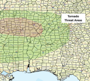
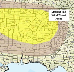
Increasing instability has led to an expansion of the Slight Risk across much of the state. Discrete cells as well as clusters of storms could produce damaging straight-line winds, very large hail (golf ball or larger), torrential downpours resulting in localized flooding, and a few tornadoes. The highest threat of tornadoes is generally north of I-20 and west of I-65, but a couple could develop anywhere within the state.
A decrease in storm intensity is forecast after 12 am.
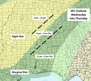
Scattered showers and a few non-severe thunderstorms are possible north of I-20 on Tuesday. A potent upper level system will drive a strong cold front through the state Wednesday night through Thursday morning. A line of strong to severe storms will enter the western sections on Wednesday afternoon or evening and exit the southeastern portions on Thursday morning. In addition, a few supercells may develop ahead of the line of storms.
Damaging wind gusts, hail, a few tornadoes, and very heavy rainfall will all be possible. There are still some model disagreements about this system’s timing, so expect some changes over the next day or two.


